
King Tides Event at Estuary Helps Predict Future Environmental Conditions
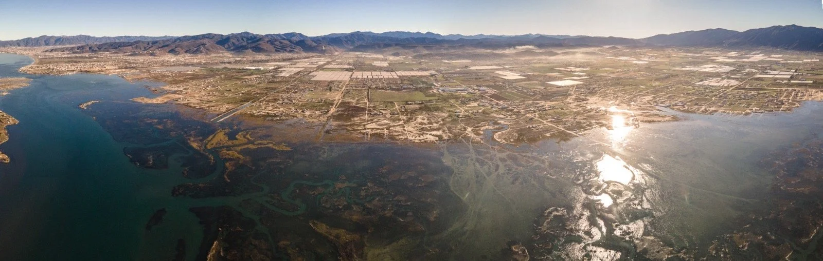
Photo of the estuary taken by Carl Tremblay using his drone during the peak of king tide on December 5
On December 5, the Punta Banda Conservation Alliance and San Diego Bird Alliance co-hosted the First Binational King Tides Event, which happened simultaneously at two sites in the United States (Kendall-Frost Marsh in San Diego) and Mexico (Punta Banda Estuary). Communities on both sides of the border attended to document extreme high tides by taking photos and recording conditions throughout the day.
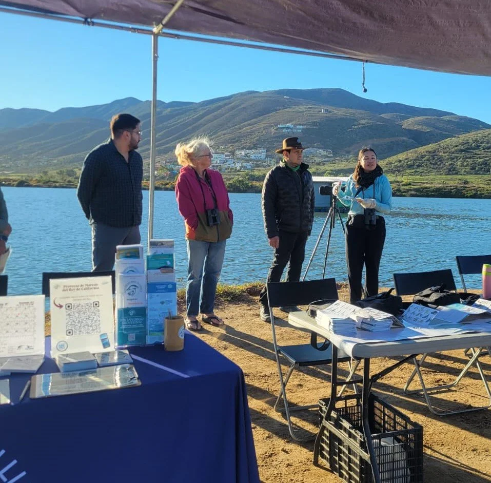
Alliance Steering Committee members (left to right) Hiram Moreno, El Berryman, Ivan Marquez, and Laura Ibarra introducing the event to participants. Educational material was provided by San Diego Bird Alliance and Pro Esteros.
This Binational King Tides Event was part of a larger ongoing California King Tides project put together by a partnership of many federal (United States) and state (California) agencies and nonprofit organizations. The purpose of the project is to help visualize future conditions after sea level rise, by observing the highest tides of the day. Participants up and down the Pacific coast help by taking and sharing photos of the shoreline during king tide to create a record of changes to our coast and estuaries. Since its inception in 2010, the King Tides Project has grown into a global network of initiatives. The December event was the first time Baja California was included.
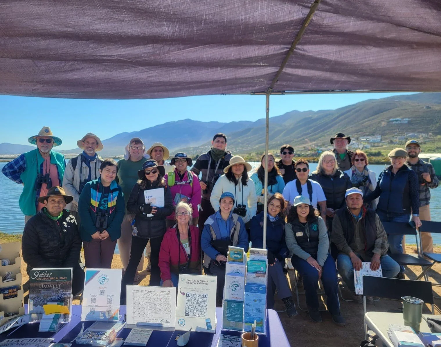
King tide event participants at Punta Banda Estuary.
King tides are the highest tides of the year, caused when there is alignment of the gravitational pull between sun, moon, and Earth. For an in-depth explanation of how the sun, moon, and Earth work together to create king tides (plus a cool word - syzygy!), click here. When king tides occur during floods or storms, water levels can rise even higher and potentially cause damage to coastlines and coastal property.
Increases in global sea levels have been recorded by tide gauges since the late 1800s, and more recent observations have been collected by NASA satellites. Sea levels are rising because land-based glaciers and ice sheets are melting into the ocean and also because oceans are warming, causing them to expand (click here to see how that works).
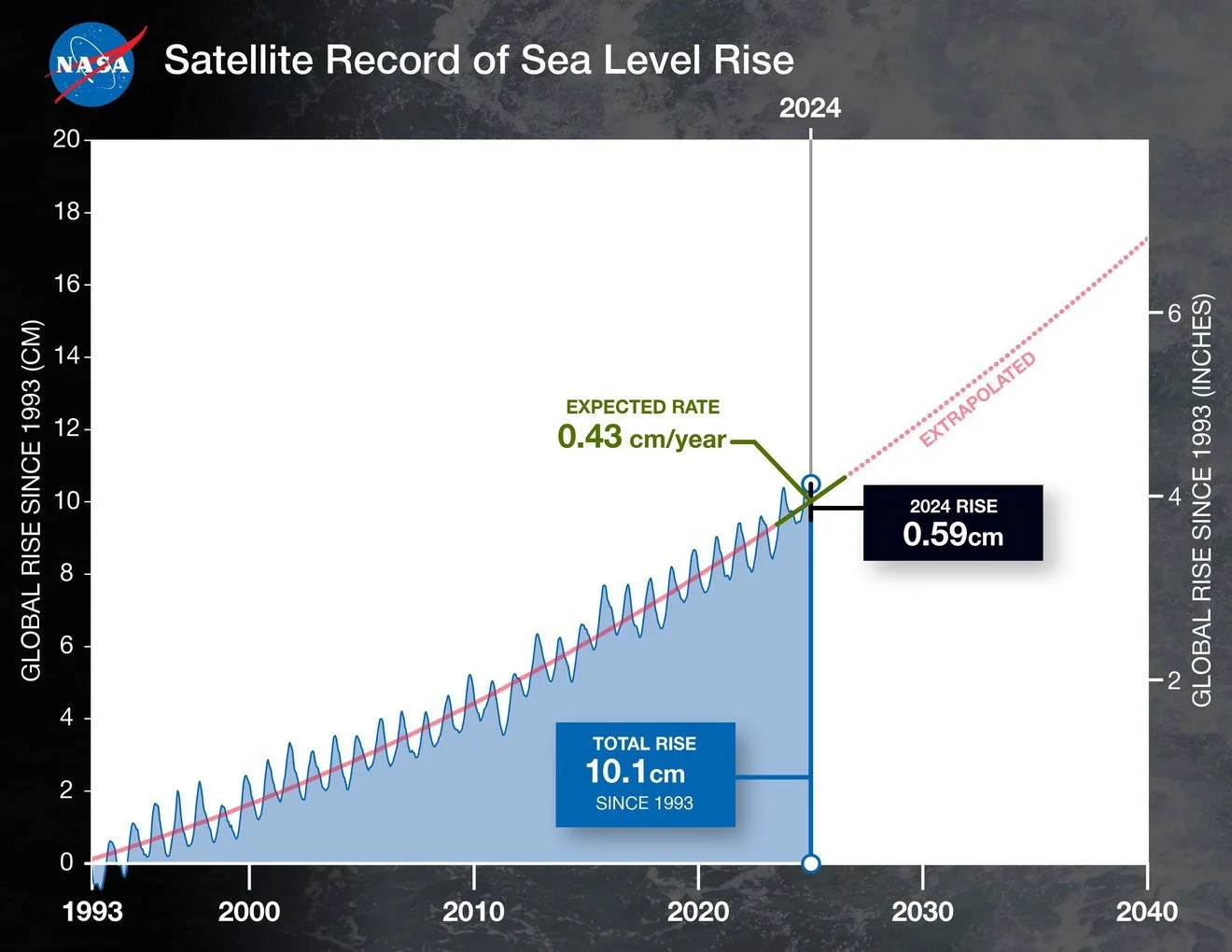
This graph shows global mean sea level (in blue) since 1993 as measured by a series of five satellites. The solid red line indicates the trajectory of this increase, which has more than doubled over the past three decades. The dotted red line projects future sea level rise. Credit: NASA/JPL-Caltech
While king tides aren’t actually related to climate change, they allow us to experience what higher sea level will be like on the coastlines. King Tides are one to two feet higher than average high tides, which is about how high we expect everyday tides to be over the next few decades due to sea level rise. Understanding what a king tide looks like today will help us plan for future sea level rise.
Participants in the King Tide Project at the estuary used their smart phones or digital cameras to take photos of the king tide and upload them using the King Tides Photo Upload form. In addition to helping to visualize the impacts of future sea level rise in the community, these photos will also be used to document current flood risks and to validate climate change models by comparing model predictions with the high-tide reality.
In addition to documenting king tide, participants at the event enjoyed each others’ company over coffee and snacks, bird watching, and painting. Punta Banda Conservation Alliance proclaims this first binational event a success, and hopes to host this event for years to come! See you for the high tide next winter! The date will be posted on our calendar as soon as we know it.
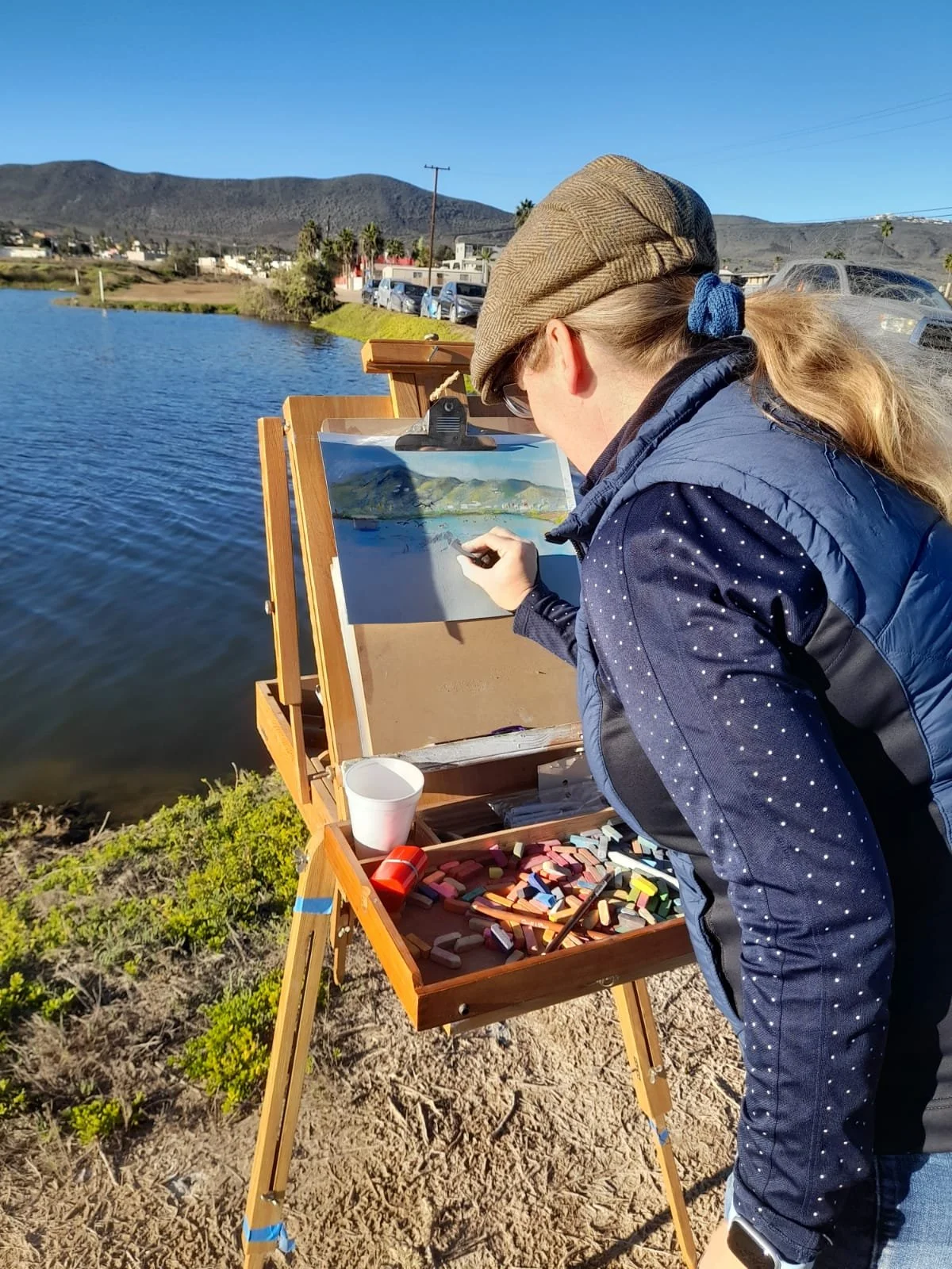
Plenaire Painting
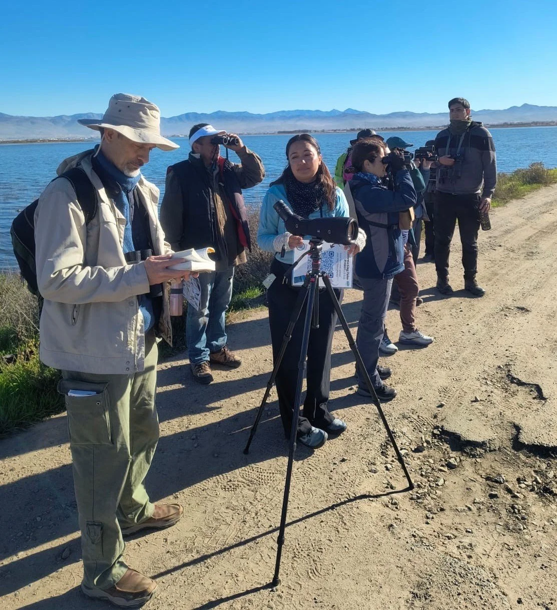
Bird watching